Category: StreetPage 9 of 11


600 S Main Street looking North. Grain trucks line up waiting to deliver. Visible is the roof of 520 S Main Street.

Visible in this aerial photo of the Audubon and East End is the Louisville & Nashville and Illinois Central railroad tracks, Home Oil & Gas bulk plant, Audubon…

In this 1959 photo, the North Y can be seen in the distance. Among the businesses and landmarks visible are, from left on the left side of the…

2000 block of Clay Street looking West. Dixie Mart and Dollar General location at 2022 Clay. Google Location

View of N Main Street in the 200 block, looking South. Visible is Union Bank & Trust at 201 N Main, William Soaper Building at 213-219 N Main,…

Second Street looking East from Main Street. Visible is Ohio Valley National Bank, Hotel Kingdon, and Mann Brothers.

Photo taken during a parade at First and Green Streets. Visible is the original Rudy-Rowland Undertaking and Livery Company building.

213 and 221 Second Street A crowd lines up on opening day at the Belk-Henderson Store at 213 Second Street on June 1, 1946. Quinn’s Rexall drugstore is…

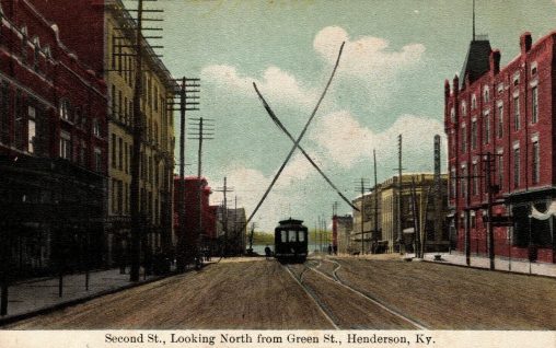
Visible is Mann Bros, Farmers Bank and Trust, and Ohio Valley National Bank. Note the Henderson Traction Car.